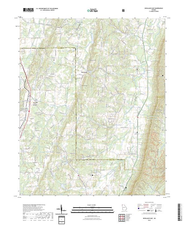
2024 Map of Nickajack Gap
USGS Topo · Published 2024About this map
Peavine Valley and the surrounding ridges of Northwest Georgia define a landscape of longstanding family settlements and community landmarks. This 2024 survey captures the convergence of Walker and Catoosa counties, where the rural character of Beaumont and Rock Spring persists alongside newer developments. The terrain is marked by prominent landforms such as Peavine Ridge, Beaumont Mtn, and Taylor Ridge, which channel the flow of Little Chickamauga Creek and its many tributaries like Rock Spring Creek.
Find a feature on this map
97 named features on this map. Tap any name to fly to it.
Don’t see what you’re looking for? This feature index may not catch every label — zoom into the map to look around manually.
Map Details
Editions of this 2024 Nickajack Gap Map
This is the sole edition of this map. No revisions or reprints were ever made.
Other maps of this area

1886 · Ringgold
USGS Topo · 1:125,000

1892 · Ringgold
USGS Topo · 1:125,000

1935 · Catlett
USGS Topo · 1:24,000

1935 · East Ridge
USGS Topo · 1:24,000

1935 · Villanow
USGS Topo · 1:24,000

1935 · Ringgold
USGS Topo · 1:24,000

1935 · Nickajack Gap
USGS Topo · 1:24,000

1935 · Tunnel Hill
USGS Topo · 1:24,000

1936 · Kensington
USGS Topo · 1:24,000

1936 · Estelle
USGS Topo · 1:24,000