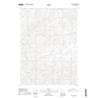
2020 Map of Nickel Mountain
USGS Topo · Published 2020About this map
Riddle occupies the eastern edge of this landscape, situated near the banks of Cow Creek. The area is defined by sharp elevation changes and high ridges, notably Nickel Mtn and Mt Isaac, which loom over the lower plateaus of Jerry Flat and Baker Flat. This 2020 survey illustrates a complex network of resource-extraction infrastructure, including a web of forest access points like Nickel Mine Rd and numerous Logging Rd segments that penetrate the high country.
Find a feature on this map
78 named features on this map. Tap any name to fly to it.
Don’t see what you’re looking for? This feature index may not catch every label — zoom into the map to look around manually.
Map Details
Editions of this 2020 Nickel Mountain Map
This is the sole edition of this map. No revisions or reprints were ever made.
Other maps of this area

1897 · Roseburg
USGS Topo · 1:125,000

1900 · Roseburg
USGS Topo · 1:125,000

1904 · Riddle
USGS Topo · 1:125,000

1928 · Sitkum
USGS Topo · 1:125,000

1946 · Dutchman Butte
USGS Topo · 1:62,500

1948 · Dutchman Butte
USGS Topo · 1:62,500

1954 · Canyonville
USGS Topo · 1:62,500

1955 · Camas Valley
USGS Topo · 1:62,500

1955 · Roseburg
USGS Topo · 1:62,500

1955 · Medford
USGS Topo · 1:250,000