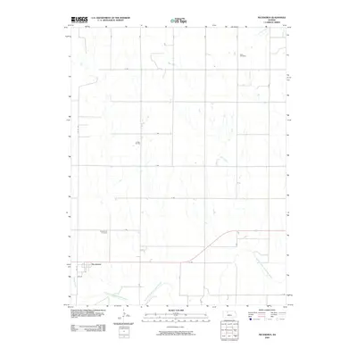
2009 Map of Nicodemus
USGS Topo · Published 2009About this map
Nicodemus and its surrounding Graham County landscape are defined by the winding course of the South Fork Solomon River and a grid of rural section roads. This 2009 survey highlights the town's street plan, including 7th St and 6th St, alongside essential community landmarks like the Nicodemus Cemetery. To the north, the terrain is drained by Slate Creek and Sand Creek, where the Slate Cemetery sits as a quiet marker of the area's pioneer history. Industrial activity is present at the La Sage Oil Field, which contrasts with the traditional agricultural character of the plains. The map provides a detailed view of the local drainage system, including Spring Creek, and the persistent road network that has structured this prairie settlement for generations.
Find a feature on this map
27 named features on this map. Tap any name to fly to it.
Don’t see what you’re looking for? This feature index may not catch every label — zoom into the map to look around manually.
Map Details
Editions of this 2009 Nicodemus Map
This is the sole edition of this map. No revisions or reprints were ever made.
Other maps of this area

1893 · Norton
USGS Topo · 1:125,000

1893 · Phillipsburg
USGS Topo · 1:125,000

1893 · Hill
USGS Topo · 1:125,000

1896 · Plainville
USGS Topo · 1:125,000

1952 · Webster Dam
USGS Topo · 1:24,000

1955 · Beloit
USGS Topo · 1:250,000

1959 · Beloit
USGS Topo · 1:250,000

1969 · Nicodemus
USGS Topo · 1:24,000

1969 · Palco
USGS Topo · 1:24,000

1969 · Stockton SW
USGS Topo · 1:24,000