2022 Map of Nicodemus
USGS Topo · Published 2022About this map
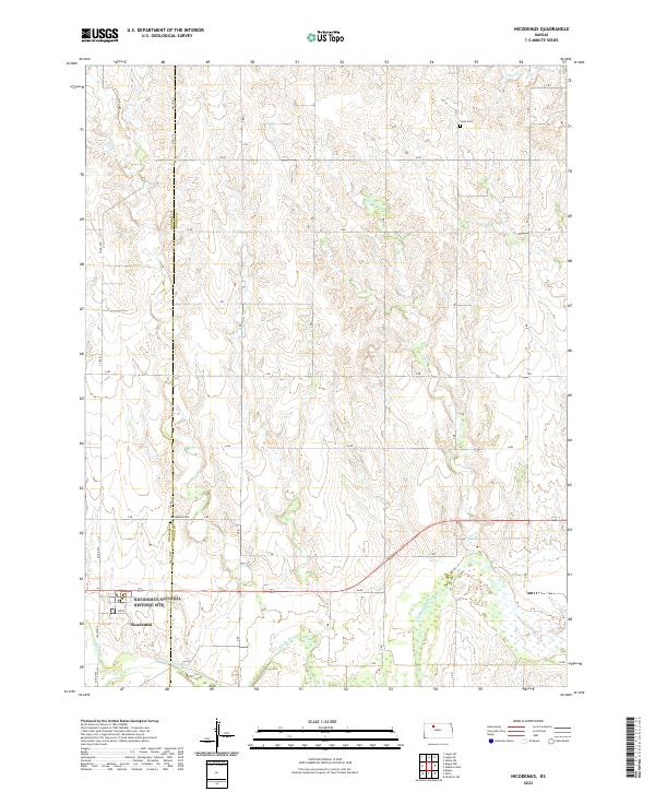
Nicodemus stands as the primary focal point of this Northwest Kansas landscape, particularly significant as the only remaining town established by African Americans during the Reconstruction period following the Civil War. The map centers on the Nicodemus National Historic Site, preserving the legacy of the Exoduster movement. To the south, the S Fork Solomon River meanders across the terrain, joined by Spring Creek near the townsite. The surrounding landscape is defined by a grid of rural routes including 400th Ave and M Rd, which separate the agricultural sections of Graham and Rooks counties. Local genealogy is anchored by the Nicodemus Cem just outside the main settlement and Slate Cem situated to the northeast near Slate Creek, marking the enduring presence of the families who settled this prairie.
Find a feature on this map
32 named features on this map. Tap any name to fly to it.
Don’t see what you’re looking for? This feature index may not catch every label — zoom into the map to look around manually.
Map Details
Editions of this 2022 Nicodemus Map
This is the sole edition of this map. No revisions or reprints were ever made.