
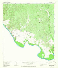
1965 Map of Nido Ranch
USGS Topo · Published 1967About this map
Nido Ranch and its surrounding South Texas landscape are defined by a sophisticated network of water management features essential for cattle operations in Webb County. The terrain is marked by numerous man-made reservoirs and wells, including Nido Tank, Huisachosa Tank, and Guajillo Tank, which capture runoff from seasonal drainages like Tejones Creek and Tordillo Creek. These water sources, often paired with wind-driven pumps such as the Pratt Windmill and El Siete Windmill, supported the scattered ranching outposts of Fresno Ranch and San Juan Ranch. A prominent Landing Strip near the headwaters of Arroyo Blanco indicates the importance of aerial access in managing these remote holdings during the mid-1960s. The presence of Gravel Pits and the South Windmill Drill Hole further reflects the localized extraction and exploration occurring alongside traditional ranching during this period.
Find a feature on this map
33 named features on this map. Tap any name to fly to it.
Don’t see what you’re looking for? This feature index may not catch every label — zoom into the map to look around manually.
Map Details
Editions of this 1965 Nido Ranch Map
This is the sole edition of this map. No revisions or reprints were ever made.
Other maps of this area

1956 · Las Tiendas
USGS Topo · 1:62,500

1956 · Islitas
USGS Topo · 1:62,500

1956 · Laredo East
USGS Topo · 1:62,500

1956 · Webb
USGS Topo · 1:62,500

1956 · Laredo
USGS Topo · 1:250,000

1965 · Orvil
USGS Topo · 1:24,000

1965 · Spohn Ranch
USGS Topo · 1:24,000

1965 · Cuervo Creek
USGS Topo · 1:24,000

1965 · Cerritos Blancos
USGS Topo · 1:24,000
1965 · Dolores Ranch
USGS Topo · 1:24,000