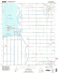
1992 Map of Niland
USGS Topo · Published 1995About this map
The eastern shores of the Salton Sea define the western edge of this Imperial County landscape, revealing an intricate network of irrigation infrastructure essential to the Coachella Valley. An extensive system of alphabetical canals and drains, including U Lateral and G Drain, crisscrosses the low-lying basin. The settlement of Niland serves as a primary hub for the region, while the southern portion of the sheet features Calipatria and the nearby Calipatria State Prison.
Find a feature on this map
77 named features on this map. Tap any name to fly to it.
Don’t see what you’re looking for? This feature index may not catch every label — zoom into the map to look around manually.
Map Details
Editions of this 1992 Niland Map
2 editions found
Other maps of this area

1940 · Iris
USGS Topo · 1:62,500

1940 · Frink
USGS Topo · 1:62,500

1940 · Iris Pass
USGS Topo · 1:62,500

1944 · Calipatria
USGS Topo · 1:62,500

1944 · Frink
USGS Topo · 1:62,500

1945 · Iris Pass
USGS Topo · 1:62,500

1945 · Iris
USGS Topo · 1:62,500

1954 · Salton Sea
USGS Topo · 1:250,000

1955 · Salton Sea
USGS Topo · 1:250,000
1956 · Iris
USGS Topo · 1:24,000