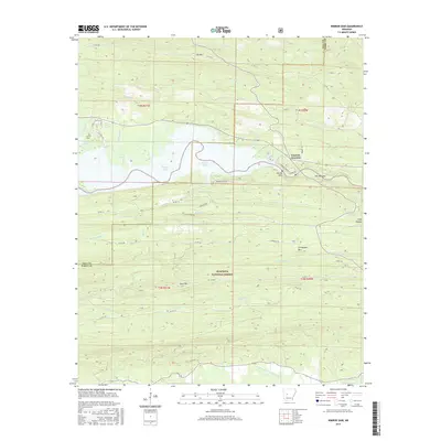
2017 Map of Nimrod Dam
USGS Topo · Published 2017About this map
Nimrod Dam controls the waters of Nimrod Lake in this section of the Ouachita National Forest, a landscape defined by the winding course of the South Fourche La Fave River. The settlement at Fourche Junction serves as a local crossroads near The Narrows, where the terrain transitions into the steep elevations of Chinquapin Mtn and Cove Mtn. The map reveals a network of rural routes such as Deimer Bluff Rd and Glenhaven Rd that navigate the ridges and hollows, including Long Hollow and the valley of Little Brushy Cr. Genealogists may find interest in the location of Carter Cem, situated near the western shoreline of the reservoir. This modern survey illustrates the persistent rural character of the Yell and Perry County border, where timberland and water management dominate the local geography.
Find a feature on this map
50 named features on this map. Tap any name to fly to it.
Don’t see what you’re looking for? This feature index may not catch every label — zoom into the map to look around manually.
Map Details
Editions of this 2017 Nimrod Dam Map
This is the sole edition of this map. No revisions or reprints were ever made.
Other maps of this area

1888 · Dardanelle #4
USGS Topo · 1:62,500

1888 · Dardanelle #3
USGS Topo · 1:62,500

1890 · Hot Springs
USGS Topo · 1:125,000

1890 · Dardanelle
USGS Topo · 1:125,000

1894 · Hot Springs
USGS Topo · 1:125,000

1955 · Little Rock
USGS Topo · 1:250,000

1956 · Little Rock
USGS Topo · 1:250,000

1956 · Russellville
USGS Topo · 1:250,000

1960 · Little Rock
USGS Topo · 1:250,000

1964 · Russellville
USGS Topo · 1:250,000