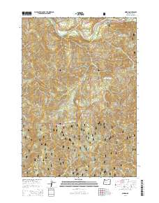
2014 Map of Nimrod
USGS Topo · Published 2014About this map
Nimrod lies at a critical bend in the McKenzie River, where the McKenzie Hwy meets the winding Goodpasture Rd. This area within the Willamette National Forest is defined by its dramatic elevation changes and a dense network of drainage creeks. Higher elevations are dominated by named summits including Pernot Mtn and Gibraltar Mtn, while the terrain is further segmented by prominent features like Marten Ridge and Williams Ridge. The river corridor serves as the primary artery for settlement and transport, with Eagle Rock Dr providing access to the northern banks. Numerous tributaries such as Silver Cr, Ennis Cr, and W Fork Deer Cr carve through the Cascade Range topography, illustrating the complex watershed that feeds into the McKenzie.
Find a feature on this map
35 named features on this map. Tap any name to fly to it.
Don’t see what you’re looking for? This feature index may not catch every label — zoom into the map to look around manually.
Map Details
Editions of this 2014 Nimrod Map
This is the sole edition of this map. No revisions or reprints were ever made.
Other maps of this area

1925 · Waldo Lake
USGS Topo · 1:125,000

1934 · Mc Kenzie Bridge
USGS Topo · 1:96,000

1935 · Lowell
USGS Topo · 1:96,000

1940 · Mc Kenzie Bridge
USGS Topo · 1:125,000

1942 · Lowell
USGS Topo · 1:125,000

1951 · Leaburg
USGS Topo · 1:62,500

1953 · Salem
USGS Topo · 1:250,000

1954 · Salem
USGS Topo · 1:250,000

1955 · Hardesty Mtn
USGS Topo · 1:62,500

1955 · Blue River
USGS Topo · 1:62,500