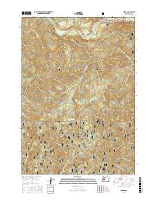
2017 Map of Nimrod
USGS Topo · Published 2017About this map
The McKenzie River flows through the northern reaches of this territory, where the small settlement of Nimrod sits along Highway 126. This corridor represents the primary point of access into the heavily timbered lands of the Willamette National Forest, which covers the majority of the landscape. The geography is defined by a series of prominent ridges and peaks, including Marten Ridge, Nimrod Butte, and Gibraltar Mtn, all situated within the Cascade Range. The intricate network of drainage is visible through numerous named waterways like Quartz Cr, Silver Cr, and W Fork Deer Cr. A system of specialized forest routes, such as Natl Forest Develop Road 1831 RD, provides a window into the management and accessibility of these public lands during the early 21st century.
Find a feature on this map
38 named features on this map. Tap any name to fly to it.
Don’t see what you’re looking for? This feature index may not catch every label — zoom into the map to look around manually.
Map Details
Editions of this 2017 Nimrod Map
This is the sole edition of this map. No revisions or reprints were ever made.
Other maps of this area

1925 · Waldo Lake
USGS Topo · 1:125,000

1934 · Mc Kenzie Bridge
USGS Topo · 1:96,000

1935 · Lowell
USGS Topo · 1:96,000

1940 · Mc Kenzie Bridge
USGS Topo · 1:125,000

1942 · Lowell
USGS Topo · 1:125,000

1951 · Leaburg
USGS Topo · 1:62,500

1953 · Salem
USGS Topo · 1:250,000

1954 · Salem
USGS Topo · 1:250,000

1955 · Hardesty Mtn
USGS Topo · 1:62,500

1955 · Blue River
USGS Topo · 1:62,500