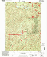
1997 Map of Nimrod
USGS Topo · Published 2001About this map
The MC Kenzie River carves a narrow valley through this portion of Lane County, defining the local geography with its series of whitewater features like Eagle Rock Rapids and Hells Rapids. The settlement of Nimrod and the nearby Holman Station serve as the primary human touchpoints in an otherwise heavily forested landscape. Recreation is a central theme along the river corridor, evidenced by numerous access points including Rennie Landing Boat Ramp, McMullins Landing, and Sheppard Landing. Beyond the river banks, the terrain rises sharply toward peaks such as Nimrod Butte and Permot Mountain. Large sections of the map are designated within the Willamette National Forest, while smaller protected areas like Clover Point County Park and Howard J Morton State Park provide more localized public access to the river's edge.
Find a feature on this map
37 named features on this map. Tap any name to fly to it.
Don’t see what you’re looking for? This feature index may not catch every label — zoom into the map to look around manually.
Map Details
Editions of this 1997 Nimrod Map
This is the sole edition of this map. No revisions or reprints were ever made.
Other maps of this area

1925 · Waldo Lake
USGS Topo · 1:125,000

1934 · Mc Kenzie Bridge
USGS Topo · 1:96,000

1935 · Lowell
USGS Topo · 1:96,000

1940 · Mc Kenzie Bridge
USGS Topo · 1:125,000

1942 · Lowell
USGS Topo · 1:125,000

1951 · Leaburg
USGS Topo · 1:62,500

1953 · Salem
USGS Topo · 1:250,000

1954 · Salem
USGS Topo · 1:250,000

1955 · Hardesty Mtn
USGS Topo · 1:62,500

1955 · Blue River
USGS Topo · 1:62,500