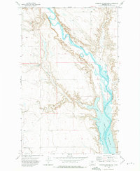
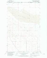
1972 Map of Ninemile Coulee East
USGS Topo · Published 1975About this map
Fresno Reservoir dominates the eastern portion of this Montana landscape, where the Milk River is captured behind the dam. The topography is defined by the deep incisions of coulees that drain the surrounding plains into the river valley. Notable drainages include Ninemile Coulee, Sevenmile Coulee, and Archie Coulee, which create a complex network of breaks and ridges. The presence of a Gravel Pit near the reservoir shoreline points to the localized industrial activity supporting regional infrastructure. This survey illustrates the intricate balance between water management and the naturally eroded terrain of Hill County, providing a clear view of the land before further contemporary development altered these drainage patterns.
Find a feature on this map
7 named features on this map. Tap any name to fly to it.
Don’t see what you’re looking for? This feature index may not catch every label — zoom into the map to look around manually.
Map Details
Editions of this 1972 Ninemile Coulee East Map
This is the sole edition of this map. No revisions or reprints were ever made.
Other maps of this area

1906 · Kremlin
USGS Topo · 1:62,500

1920 · Gildford
USGS Topo · 1:125,000

1943 · Gildford
USGS Topo · 1:125,000

1954 · Shelby
USGS Topo · 1:250,000

1958 · Shelby
USGS Topo · 1:250,000

1969 · Gildford NE
USGS Topo · 1:24,000
1969 · Saddle Butte
USGS Topo · 1:24,000
1969 · Dry Lake
USGS Topo · 1:24,000
1972 · Lost River NE
USGS Topo · 1:24,000
1972 · Wild Horse Lake West
USGS Topo · 1:24,000