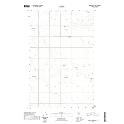
2020 Map of Ninemile Coulee West
USGS Topo · Published 2020About this map
Gildford Colony stands as the primary cultural and residential hub in this Hill County landscape, appearing here as it did in 2020. The terrain is defined by a series of significant drainage features, including the eponymous Ninemile Coulee in the southeast and Tommy Allen Coulee to the north. These coulees represent the characteristic erosional patterns of Northern Montana's plains, carving distinct paths through the high country.
Find a feature on this map
11 named features on this map. Tap any name to fly to it.
Don’t see what you’re looking for? This feature index may not catch every label — zoom into the map to look around manually.
Map Details
Editions of this 2020 Ninemile Coulee West Map
This is the sole edition of this map. No revisions or reprints were ever made.
Other maps of this area

1906 · Kremlin
USGS Topo · 1:62,500

1920 · Gildford
USGS Topo · 1:125,000

1943 · Gildford
USGS Topo · 1:125,000

1954 · Shelby
USGS Topo · 1:250,000

1958 · Shelby
USGS Topo · 1:250,000

1969 · Gildford NE
USGS Topo · 1:24,000

1969 · Gildford NW
USGS Topo · 1:24,000
1969 · Dry Lake
USGS Topo · 1:24,000
1972 · Lost River NE
USGS Topo · 1:24,000

1972 · Mc Kinnsey Reservoir East
USGS Topo · 1:24,000