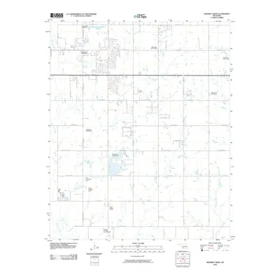
2009 Map of Ninemile Creek
USGS Topo · Published 2009About this map
Ninemile Creek and East Cache Creek define the drainage of this landscape on the eastern outskirts of Lawton during the early 21st century. The map reveals a transition from dense residential subdivisions to the west into a more open, rural-residential pattern defined by large lots and private aviation infrastructure. Unique to this quadrangle is the concentration of small landing facilities, including the Hill Top/Private Airport, Hilltop Landing Strip, and the Jerry-Wright Airfield, suggesting a community with significant private flight activity. Water management is a dominant theme of the local terrain, as evidenced by numerous small impoundments such as the Oknoname 031054 Reservoir and several named dams like Oknoname 031033 Dam. The settlement at Lawton Downs anchor the northern portion of the sheet, while the southern reaches remain relatively open around the lower course of Gooden Creek.
Find a feature on this map
44 named features on this map. Tap any name to fly to it.
Don’t see what you’re looking for? This feature index may not catch every label — zoom into the map to look around manually.
Map Details
Editions of this 2009 Ninemile Creek Map
This is the sole edition of this map. No revisions or reprints were ever made.
Other maps of this area

1946 · Lawton
USGS Topo · 1:62,500

1949 · Arbuckle Hill
USGS Topo · 1:24,000

1949 · Fort Sill
USGS Topo · 1:24,000

1949 · Nellie
USGS Topo · 1:62,500

1955 · Lawton
USGS Topo · 1:250,000

1956 · Sterling
USGS Topo · 1:24,000

1956 · Ninemile Creek
USGS Topo · 1:24,000

1956 · Arbuckle Hill
USGS Topo · 1:24,000
1956 · Fort Sill
USGS Topo · 1:24,000

1956 · Lawton
USGS Topo · 1:24,000