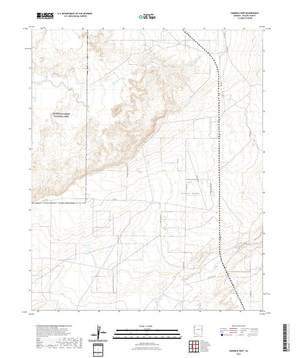
2021 Map of Ninemile Seep
USGS Topo · Published 2021About this map
Petrified Forest National Park occupies the western edge of this High Desert landscape, where the terrain transitions from protected federal lands into a network of livestock tanks and seasonal washes. The hydrology of the region is defined by the braided courses of Ninemile Wash and Milky Wash, which drain the arid plains toward Puerco Ridge. Water security in this Apache County corridor is marked by man-made catchments like Rock Tank, Reese Tank, and the seasonally variable Red Lake.
Find a feature on this map
22 named features on this map. Tap any name to fly to it.
Don’t see what you’re looking for? This feature index may not catch every label — zoom into the map to look around manually.
Map Details
Editions of this 2021 Ninemile Seep Map
This is the sole edition of this map. No revisions or reprints were ever made.
Other maps of this area

1886 · St Johns
USGS Topo · 1:250,000

1886 · Fort Defiance
USGS Topo · 1:250,000

1892 · Fort Defiance
USGS Topo · 1:250,000

1892 · St Johns
USGS Topo · 1:250,000

1954 · Saint Johns
USGS Topo · 1:250,000

1954 · Gallup
USGS Topo · 1:250,000

1955 · Adamana 1 SW
USGS Topo · 1:24,000

1956 · Adamana 1 NW
USGS Topo · 1:24,000

1957 · Saint Johns
USGS Topo · 1:250,000

1958 · Gallup
USGS Topo · 1:250,000