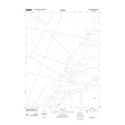
2012 Map of Ninemile Well
USGS Topo · Published 2012About this map
Ninemile Well and a series of critical water sources define this high-desert region of White Pine County. The landscape is characterized by its reliance on these established points of hydration, including Paris Well and Caboose Well, which serve as vital landmarks for those navigating the arid terrain. The road network is sparse but significant, anchored by Overland Rd and Co Rd 19, which cross the open flats between topographical rises. To the east, the elevation shifts as the land descends into Clonch Canyon or rises toward the prominent Sevenmile Point. Further south, Mustang Hill provides a distinct navigational marker. This 2012 USGS survey documents the enduring importance of these named wells and cattle-country landmarks in an area where water and reliable routes remain the primary features of human and animal movement.
Find a feature on this map
8 named features on this map. Tap any name to fly to it.
Don’t see what you’re looking for? This feature index may not catch every label — zoom into the map to look around manually.
Map Details
Editions of this 2012 Ninemile Well Map
This is the sole edition of this map. No revisions or reprints were ever made.
Other maps of this area

1955 · Elko
USGS Topo · 1:250,000

1956 · Ely
USGS Topo · 1:250,000

1958 · Elko
USGS Topo · 1:250,000

1959 · Ely
USGS Topo · 1:250,000

1962 · Elko
USGS Topo · 1:250,000

1963 · Ely
USGS Topo · 1:250,000

1965 · Elko
USGS Topo · 1:250,000

1982 · Ninemile Well
USGS Topo · 1:24,000

1982 · Exchequer Spring
USGS Topo · 1:24,000
1982 · Cow Camp
USGS Topo · 1:24,000