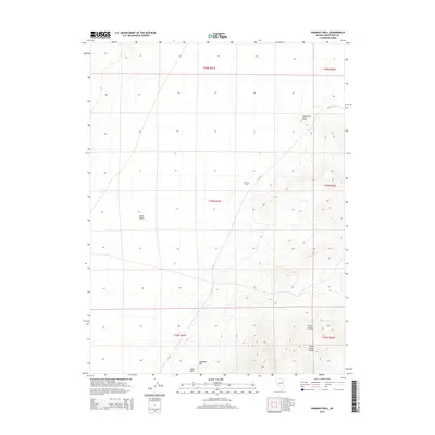
2014 Map of Ninemile Well
USGS Topo · Published 2014About this map
Butte Valley dominates the western half of this landscape, a flat expanse defined by the high desert of White Pine County. The terrain shifts dramatically in the east as it rises into the Cherry Creek Range, where the steep topography of Clonch Canyon and prominent landmarks like Sevenmile Point provide stark vertical relief. Significant local landmarks such as Mustang Hill and Black Mtn anchor the southern portion of the survey. The eponymous Ninemile Well stands as a vital water source along the primitive route of CR-19, representing the sparse but essential infrastructure required for ranching and travel in this arid Great Basin environment.
Find a feature on this map
14 named features on this map. Tap any name to fly to it.
Don’t see what you’re looking for? This feature index may not catch every label — zoom into the map to look around manually.
Map Details
Editions of this 2014 Ninemile Well Map
This is the sole edition of this map. No revisions or reprints were ever made.
Other maps of this area

1955 · Elko
USGS Topo · 1:250,000

1956 · Ely
USGS Topo · 1:250,000

1958 · Elko
USGS Topo · 1:250,000

1959 · Ely
USGS Topo · 1:250,000

1962 · Elko
USGS Topo · 1:250,000

1963 · Ely
USGS Topo · 1:250,000

1965 · Elko
USGS Topo · 1:250,000

1982 · Ninemile Well
USGS Topo · 1:24,000

1982 · Exchequer Spring
USGS Topo · 1:24,000
1982 · Cow Camp
USGS Topo · 1:24,000