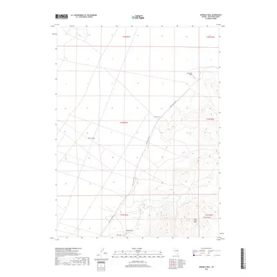
2018 Map of Ninemile Well
USGS Topo · Published 2018About this map
Butte Valley dominates the western portion of this high-desert landscape in White Pine County, where water sources like Ninemile Well serve as vital landmarks for navigation and survival. The terrain shifts dramatically to the east as the Cherry Creek Range rises from the valley floor, cut by the deep recess of Clonch Canyon. This area is defined by the practical infrastructure of the Great Basin, including White Pine Co Road 19, which traverses the arid flats to connect remote points like Sevenmile Point. To the south, high points such as Mustang Hill and Black Mtn provide vertical relief against the expansive northern Nevada horizon. The map reflects a modern inventory of this ranching and mining country, where the placement of individual wells and roads provides essential context for understanding the sparse settlement patterns and land use of the region.
Find a feature on this map
15 named features on this map. Tap any name to fly to it.
Don’t see what you’re looking for? This feature index may not catch every label — zoom into the map to look around manually.
Map Details
Editions of this 2018 Ninemile Well Map
This is the sole edition of this map. No revisions or reprints were ever made.
Other maps of this area

1955 · Elko
USGS Topo · 1:250,000

1956 · Ely
USGS Topo · 1:250,000

1958 · Elko
USGS Topo · 1:250,000

1959 · Ely
USGS Topo · 1:250,000

1962 · Elko
USGS Topo · 1:250,000

1963 · Ely
USGS Topo · 1:250,000

1965 · Elko
USGS Topo · 1:250,000

1982 · Ninemile Well
USGS Topo · 1:24,000

1982 · Exchequer Spring
USGS Topo · 1:24,000
1982 · Cow Camp
USGS Topo · 1:24,000