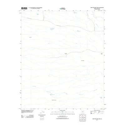
2011 Map of Ninetysix Hills NW
USGS Topo · Published 2011About this map
Mine Shaft Windmill stands as a focal point of resource management in this arid stretch of Pinal County, where water and mineral extraction define the landscape. This 2011 survey illustrates a region shaped by ephemeral drainages such as Paisano Wash and Box O Wash, which cut through the terrain between the Box O Hills and Cat Hills. The presence of numerous stock tanks, including Rincon Tank, Half Moon Tank, and Tank Number Twentytwo, highlights the ongoing importance of water catchment for cattle ranching. Transportation is anchored by the E Florence Kelvin Hwy and secondary routes like N Whitlow Ranch Rd, which provide access to the high ground of Allens Peak and Middle Mountain.
Find a feature on this map
18 named features on this map. Tap any name to fly to it.
Don’t see what you’re looking for? This feature index may not catch every label — zoom into the map to look around manually.
Map Details
Editions of this 2011 Ninetysix Hills NW Map
This is the sole edition of this map. No revisions or reprints were ever made.
Other maps of this area

1900 · Florence
USGS Topo · 1:125,000

1902 · Florence
USGS Topo · 1:125,000

1922 · Red Rock No 2
USGS Topo · 1:48,000

1934 · Newman Peak
USGS Topo · 1:125,000

1954 · Mesa
USGS Topo · 1:250,000

1956 · Tucson
USGS Topo · 1:250,000

1957 · Mesa
USGS Topo · 1:250,000

1958 · Mesa
USGS Topo · 1:250,000

1958 · Tucson
USGS Topo · 1:250,000

1959 · Tucson
USGS Topo · 1:250,000