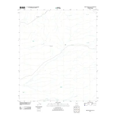
2011 Map of Ninetysix Hills SE
USGS Topo · Published 2011About this map
Ninetysix Ranch and Coyote Ranch anchor this landscape in the northern Sonoran Desert, reflecting the enduring presence of cattle ranching in Pinal County. The terrain is defined by a network of drainage channels including Tom Mix Wash and Box O Wash, which move water across the basin toward Bogard Wash in the south. These ephemeral waterways are supported by man-made infrastructure designed for livestock, such as Buck Tank, Bee Tank, and South Tank. Rising above the surrounding desert floor, Coyote Peak provides a prominent landmark for the region. Access to these remote homesteads is maintained via E 96 Ranch Rd and E Freeman Rd, demonstrating the sparse but essential transportation grid of contemporary Arizona ranchland.
Find a feature on this map
14 named features on this map. Tap any name to fly to it.
Don’t see what you’re looking for? This feature index may not catch every label — zoom into the map to look around manually.
Map Details
Editions of this 2011 Ninetysix Hills SE Map
This is the sole edition of this map. No revisions or reprints were ever made.
Other maps of this area

1911 · Winkelman
USGS Topo · 1:125,000

1913 · Winkelman
USGS Topo · 1:125,000

1934 · Newman Peak
USGS Topo · 1:125,000

1949 · Crozier Peak
USGS Topo · 1:24,000

1949 · Winkelman
USGS Topo · 1:62,500

1949 · Black Mountain
USGS Topo · 1:24,000
1950 · Crozier Peak
USGS Topo · 1:24,000
1950 · Black Mountain
USGS Topo · 1:24,000
1951 · Winkelman
USGS Topo · 1:62,500

1956 · Tucson
USGS Topo · 1:250,000