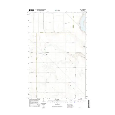
2014 Map of Niobe
USGS Topo · Published 2014About this map
Niobe lies at the intersection of county roads and section lines in this agricultural landscape of the Missouri Plateau. The settlement serves as a quiet center for the surrounding prairie, where the drainage patterns are defined by deep-cut coulees such as Ankenbauer Coulee and Niobe Coulee. To the east, the terrain drops toward the waters of Upper Des Lacs Lake, a significant geographical feature flanked by the Lac S Natl Wildlife Backway and the Canada Goose Trail.
Find a feature on this map
37 named features on this map. Tap any name to fly to it.
Don’t see what you’re looking for? This feature index may not catch every label — zoom into the map to look around manually.
Map Details
Editions of this 2014 Niobe Map
This is the sole edition of this map. No revisions or reprints were ever made.
Other maps of this area

1947 · Bowbells
USGS Topo · 1:24,000

1948 · Kenmare
USGS Topo · 1:24,000

1948 · Coteau
USGS Topo · 1:24,000

1948 · Vanville NE
USGS Topo · 1:24,000

1949 · Mosquito Butte
USGS Topo · 1:24,000

1949 · Bowbells
USGS Topo · 1:24,000

1949 · Bowbells SE
USGS Topo · 1:24,000

1949 · Niobe
USGS Topo · 1:24,000

1949 · Coulee
USGS Topo · 1:24,000

1950 · Vanville NE
USGS Topo · 1:24,000