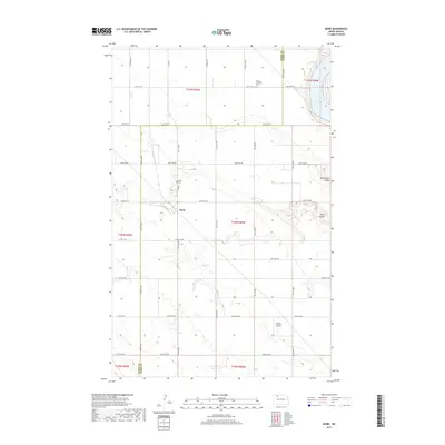
2017 Map of Niobe
USGS Topo · Published 2017About this map
Niobe anchors this section of the North Dakota plains, situated at the junction of Co HWY 2 and Co HWY 2a. The landscape is defined by the drainage patterns of several distinct coulees, including Ankenbauer Coulee, Niobe Coulee, and Taskers Coulee, which carve through the high prairie. In the northeast corner, the terrain drops significantly toward the shore of Upper Des Lacs Lake, part of a larger glacial river valley system. For those tracing local history, the map provides precise locations for the Niobe Cem and the Bethany Lutheran Cem, the latter situated just north of the county line. The grid of section lines and gravel roads, such as 436th Ave NW and 576th ST NW, illustrates the enduring structure of the township-and-range survey system in Ward and Burke counties.
Find a feature on this map
45 named features on this map. Tap any name to fly to it.
Don’t see what you’re looking for? This feature index may not catch every label — zoom into the map to look around manually.
Map Details
Editions of this 2017 Niobe Map
This is the sole edition of this map. No revisions or reprints were ever made.
Other maps of this area

1947 · Bowbells
USGS Topo · 1:24,000

1948 · Kenmare
USGS Topo · 1:24,000

1948 · Coteau
USGS Topo · 1:24,000

1948 · Vanville NE
USGS Topo · 1:24,000

1949 · Mosquito Butte
USGS Topo · 1:24,000

1949 · Bowbells
USGS Topo · 1:24,000

1949 · Bowbells SE
USGS Topo · 1:24,000

1949 · Niobe
USGS Topo · 1:24,000

1949 · Coulee
USGS Topo · 1:24,000

1950 · Vanville NE
USGS Topo · 1:24,000