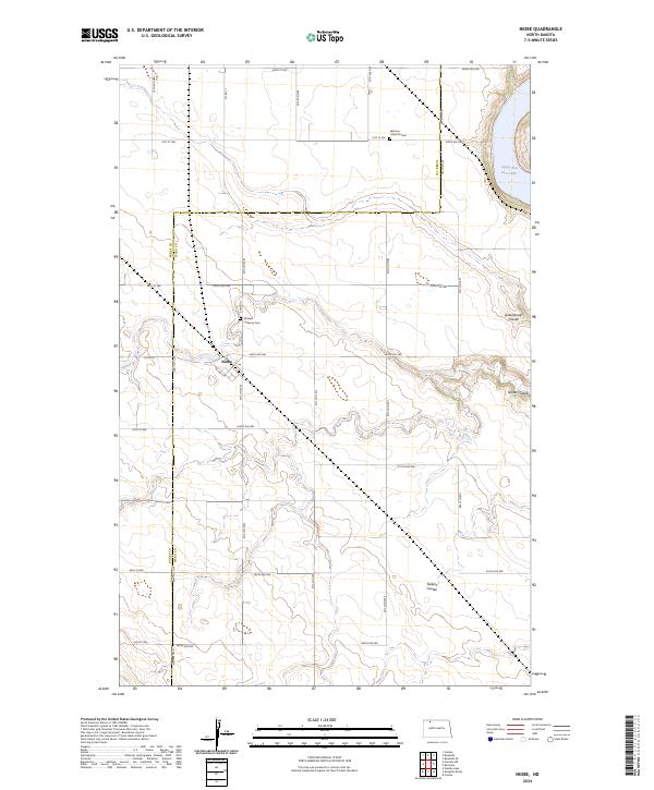
2024 Map of Niobe
USGS Topo · Published 2024About this map
Niobe is the primary settlement on this North Dakota prairie landscape, situated along the Canadian Pacific rail line. This northern Ward County terrain is defined by its dramatic relief, where the flat upland agricultural fields are deeply incised by multiple drainage features including Ankenbauer Coulee, Niobe Coulee, and Taskers Coulee. These coulees direct water toward the eastern edge of the map into Upper Des Lacs Lake, which is protected as part of the Des Lacs National Wildlife Refuge. Regional heritage is centered on community institutions such as Bethany Lutheran Cem and Elmdale Lutheran Cem, which serve as landmarks for the surrounding rural sections. The map also highlights conservation efforts within the Ward County Waterfowl Production Area, reflecting the area's importance to the migratory bird corridor.
Find a feature on this map
36 named features on this map. Tap any name to fly to it.
Don’t see what you’re looking for? This feature index may not catch every label — zoom into the map to look around manually.
Map Details
Editions of this 2024 Niobe Map
This is the sole edition of this map. No revisions or reprints were ever made.
Other maps of this area

1947 · Bowbells
USGS Topo · 1:24,000

1948 · Kenmare
USGS Topo · 1:24,000

1948 · Coteau
USGS Topo · 1:24,000

1948 · Vanville NE
USGS Topo · 1:24,000

1949 · Mosquito Butte
USGS Topo · 1:24,000

1949 · Bowbells
USGS Topo · 1:24,000

1949 · Bowbells SE
USGS Topo · 1:24,000

1949 · Niobe
USGS Topo · 1:24,000

1949 · Coulee
USGS Topo · 1:24,000

1950 · Vanville NE
USGS Topo · 1:24,000