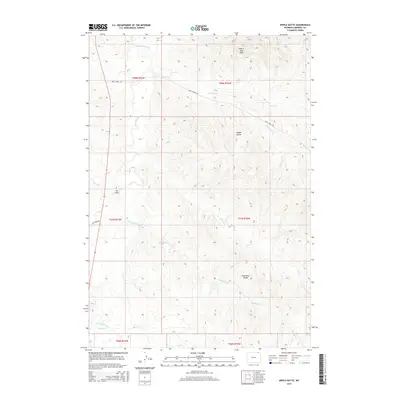
2015 Map of Nipple Butte
USGS Topo · Published 2015About this map
The Little Powder River winds through this section of Campbell County, carving a wide valley through a landscape defined by significant drainage systems and high points. This 2015 topography shows a network of creeks and draws that dictate the layout of the land, including the Eightyfive Cr system and Dry Trail Cr. Notable landmarks such as Nipple Butte and the Prairie Dog Hills rise above the surrounding terrain, while Eightyfive Divide marks a key geographic separation in the southeastern quadrant. Human presence is sparse, concentrated primarily along rural routes like Trail Creek Rd and Olmstead Rd. The map illustrates a classic High Plains rangeland character, where names like Ash Draw and Corral Cr suggest a history of cattle ranching and seasonal water management in a semi-arid environment.
Find a feature on this map
22 named features on this map. Tap any name to fly to it.
Don’t see what you’re looking for? This feature index may not catch every label — zoom into the map to look around manually.
Map Details
Editions of this 2015 Nipple Butte Map
This is the sole edition of this map. No revisions or reprints were ever made.
Other maps of this area

1954 · Ekalaka
USGS Topo · 1:250,000

1954 · Gillette
USGS Topo · 1:250,000

1955 · Gillette
USGS Topo · 1:250,000

1956 · Ekalaka
USGS Topo · 1:250,000

1958 · Gillette
USGS Topo · 1:250,000

1958 · Ekalaka
USGS Topo · 1:250,000

1962 · Gillette
USGS Topo · 1:250,000

1965 · Ekalaka
USGS Topo · 1:250,000

1970 · Wild Bill Creek
USGS Topo · 1:24,000

1970 · Belle Creek SW
USGS Topo · 1:24,000