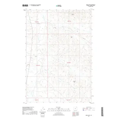
2017 Map of Nipple Butte
USGS Topo · Published 2017About this map
Little Powder River winds through the northern reaches of this Campbell County terrain, carving a drainage system that defines the local topography. This 2017 survey shows a landscape dominated by high points and divides, most notably the namesake Nipple Butte and the Prairie Dog Hills to the northeast. The map provides a detailed view of the watercourses that have shaped this portion of Wyoming, including Eightyfive Cr and Dry Trail Cr, which feed into the primary river valley. High ground is marked by the Eightyfive Divide and Ash Draw, where the elevation shifts between the various creek beds. This is a region defined by its hydrology and landforms, where human access is carved out through routes like Trail Creek Rd and Olmstead Rd, tracing the paths of earlier settlement and ranching efforts.
Find a feature on this map
23 named features on this map. Tap any name to fly to it.
Don’t see what you’re looking for? This feature index may not catch every label — zoom into the map to look around manually.
Map Details
Editions of this 2017 Nipple Butte Map
This is the sole edition of this map. No revisions or reprints were ever made.
Other maps of this area

1954 · Ekalaka
USGS Topo · 1:250,000

1954 · Gillette
USGS Topo · 1:250,000

1955 · Gillette
USGS Topo · 1:250,000

1956 · Ekalaka
USGS Topo · 1:250,000

1958 · Gillette
USGS Topo · 1:250,000

1958 · Ekalaka
USGS Topo · 1:250,000

1962 · Gillette
USGS Topo · 1:250,000

1965 · Ekalaka
USGS Topo · 1:250,000

1970 · Wild Bill Creek
USGS Topo · 1:24,000

1970 · Belle Creek SW
USGS Topo · 1:24,000