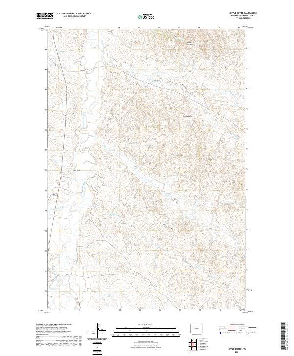
2021 Map of Nipple Butte
USGS Topo · Published 2021About this map
The Little Powder River meanders through this portion of Campbell County, carving a distinct valley through the high plains. This 2021 landscape is defined by its drainage network, where seasonal waterways like Corral Cr and Olmstead Cr feed into the river system. Elevations rise toward the northeast at the Prairie Dog Hills, while the prominent landmark of Nipple Butte stands as a focal point in the central terrain. Human imprint remains sparse, concentrated primarily along unpaved routes such as Trail Creek Rd and Olmstead Rd. Further south, the high ground of the Eightyfive Divide separates the local basins, guiding the flow of Eightyfive Cr and Bell Cr. This survey illustrates the modern ranching and grazing layout of the region, emphasizing the relationship between limited water sources and the topography of the Powder River Basin.
Find a feature on this map
22 named features on this map. Tap any name to fly to it.
Don’t see what you’re looking for? This feature index may not catch every label — zoom into the map to look around manually.
Map Details
Editions of this 2021 Nipple Butte Map
This is the sole edition of this map. No revisions or reprints were ever made.
Other maps of this area

1954 · Ekalaka
USGS Topo · 1:250,000

1954 · Gillette
USGS Topo · 1:250,000

1955 · Gillette
USGS Topo · 1:250,000

1956 · Ekalaka
USGS Topo · 1:250,000

1958 · Gillette
USGS Topo · 1:250,000

1958 · Ekalaka
USGS Topo · 1:250,000

1962 · Gillette
USGS Topo · 1:250,000

1965 · Ekalaka
USGS Topo · 1:250,000

1970 · Wild Bill Creek
USGS Topo · 1:24,000

1970 · Belle Creek SW
USGS Topo · 1:24,000