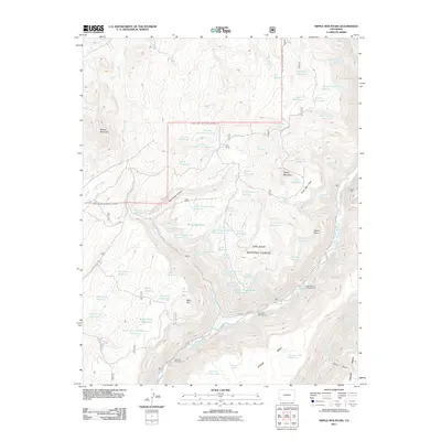
2011 Map of Nipple Mountain
USGS Topo · Published 2011About this map
King Ranch sits near the center of this 2011 survey, a lone named settlement in a landscape defined by an extensive system of water management. The terrain is characterized by a series of named reservoirs and lakes, such as Dressel Reservoir, Dutchman Lake, and Nipple Lake, which collect runoff from the surrounding high country. These water features serve a network of canyons and flats, including Mavreeso Canyon and the broad Hugh Ray Flats.
Find a feature on this map
77 named features on this map. Tap any name to fly to it.
Don’t see what you’re looking for? This feature index may not catch every label — zoom into the map to look around manually.
Map Details
Editions of this 2011 Nipple Mountain Map
This is the sole edition of this map. No revisions or reprints were ever made.
Other maps of this area

1897 · Rico
USGS Topo · 1:62,500

1898 · Rico
USGS Topo · 1:62,500

1899 · Rico
USGS Topo · 1:62,500

1956 · Cortez
USGS Topo · 1:250,000

1958 · Cortez
USGS Topo · 1:250,000

1959 · Cortez
USGS Topo · 1:250,000

1962 · Cortez
USGS Topo · 1:250,000

1963 · Stoner
USGS Topo · 1:24,000
1963 · Wallace Ranch
USGS Topo · 1:24,000
1963 · Nipple Mountain
USGS Topo · 1:24,000