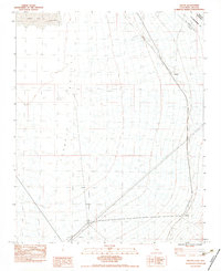
1983 Map of Nipton
USGS Topo · Published 1983About this map
Nipton serves as a lonely outpost along the Union Pacific rail line in the high desert of the Ivanpah Valley. This 1983 provisional survey documents a landscape defined by its transit history and arid geography, sitting precisely at the border between Nevada and San Bernardino Co, California. The map clearly delineates the Von Schmidt Line (1873), an important historical surveying boundary that has long influenced land claims in the Mojave region.
Find a feature on this map
11 named features on this map. Tap any name to fly to it.
Don’t see what you’re looking for? This feature index may not catch every label — zoom into the map to look around manually.
Map Details
Editions of this 1983 Nipton Map
2 editions found
Other maps of this area

1910 · Ivanpah
USGS Topo · 1:250,000

1912 · Ivanpah
USGS Topo · 1:250,000

1942 · Ivanpah
USGS Topo · 1:250,000

1947 · Kingman
USGS Topo · 1:250,000

1948 · Kingman
USGS Topo · 1:250,000

1954 · Kingman
USGS Topo · 1:250,000

1955 · Kingman
USGS Topo · 1:250,000

1955 · Roach Lake
USGS Topo · 1:62,500

1956 · Ivanpah
USGS Topo · 1:62,500
1956 · Crescent Peak
USGS Topo · 1:62,500