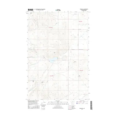
2017 Map of Nirling Hill
USGS Topo · Published 2017About this map
Lower Willow Cr Reservoir serves as a focal point for this Granite County landscape, where the water management systems of the high plains meet the rising slopes of the Northern Rockies. The map details a sophisticated network of irrigation features including the Allen-Dale Ditch, Dooley Ditch, and Conn Ditch, illustrating the area's agricultural reliance on redirected mountain runoff. Surrounding the basin are significant geological markers such as Nirling Hill, Sugarloaf, and the distinctively named The Eyebrow. Transportation routes like State Hwy 513 and Lower Willow Creek Rd navigate the contours between Harvey Ridge and Silver King Ridge, while local history is hinted at through named tracks such as Conn Homestead Ln and geographic identifiers like Gaylord Gulch.
Find a feature on this map
35 named features on this map. Tap any name to fly to it.
Don’t see what you’re looking for? This feature index may not catch every label — zoom into the map to look around manually.
Map Details
Editions of this 2017 Nirling Hill Map
This is the sole edition of this map. No revisions or reprints were ever made.
Other maps of this area

1908 · Philipsburg
USGS Topo · 1:125,000

1919 · Drummond
USGS Topo · 1:125,000

1921 · Drummond
USGS Topo · 1:125,000

1947 · Butte
USGS Topo · 1:250,000

1958 · Butte
USGS Topo · 1:250,000

1958 · Drummond
USGS Topo · 1:62,500

1959 · Bearmouth
USGS Topo · 1:62,500

1960 · Butte
USGS Topo · 1:250,000

1962 · Butte
USGS Topo · 1:250,000

1971 · Henderson Mountain
USGS Topo · 1:24,000