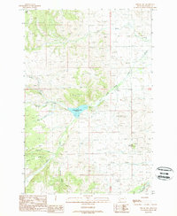
1989 Map of Nirling Hill
USGS Topo · Published 1989About this map
Nirling Hill serves as a prominent landmark in this upland portion of Granite County, where the drainage network of the Sapphire Mountains shapes the landscape. The hydrology of the area is dominated by the Lower Willow Creek Reservoir, which collects various mountain streams including Lower Willow Creek and Cow Creek. This 1989 provisional survey reveals a landscape largely defined by its natural topography and resource extraction, evidenced by several Gravel Pit locations and the rugged corridors of Harvey Ridge and Silver King Ridge.
Find a feature on this map
22 named features on this map. Tap any name to fly to it.
Don’t see what you’re looking for? This feature index may not catch every label — zoom into the map to look around manually.
Map Details
Editions of this 1989 Nirling Hill Map
This is the sole edition of this map. No revisions or reprints were ever made.
Other maps of this area

1908 · Philipsburg
USGS Topo · 1:125,000

1919 · Drummond
USGS Topo · 1:125,000

1921 · Drummond
USGS Topo · 1:125,000

1947 · Butte
USGS Topo · 1:250,000

1958 · Butte
USGS Topo · 1:250,000

1958 · Drummond
USGS Topo · 1:62,500

1959 · Bearmouth
USGS Topo · 1:62,500

1960 · Butte
USGS Topo · 1:250,000

1962 · Butte
USGS Topo · 1:250,000

1971 · Henderson Mountain
USGS Topo · 1:24,000