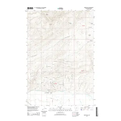
2014 Map of Nixon Gulch
USGS Topo · Published 2014About this map
The Gallatin River and East Gallatin River converge in this high-altitude landscape of Gallatin County, defining a complex drainage system within the Horseshoe Hills. In 2014, the area around the settlement of Nixon Gulch is characterized by its network of named mountain passes and gulches, such as Big Davis Gulch and Cottonwood Gulch, which dictate the local transportation routes. A significant concentration of trails and secondary roads, including the Gallatin River Bridge, Jumping Fish Trl, and Bonanza Trl, indicates a region utilized for recreation and access through the elevated terrain. Water sources like White Spring and Bullrun Cr provide essential points of interest in this semi-arid upland environment.
Find a feature on this map
47 named features on this map. Tap any name to fly to it.
Don’t see what you’re looking for? This feature index may not catch every label — zoom into the map to look around manually.
Map Details
Editions of this 2014 Nixon Gulch Map
This is the sole edition of this map. No revisions or reprints were ever made.
Other maps of this area

1886 · Fort Logan
USGS Topo · 1:250,000

1888 · Three Forks
USGS Topo · 1:250,000

1894 · Three Forks
USGS Topo · 1:250,000

1895 · Three Forks
USGS Topo · 1:250,000

1947 · Bozeman
USGS Topo · 1:250,000

1948 · Bozeman
USGS Topo · 1:250,000

1948 · White Sulphur Springs
USGS Topo · 1:250,000

1949 · Manhattan
USGS Topo · 1:62,500

1949 · Maudlow
USGS Topo · 1:62,500

1949 · Toston
USGS Topo · 1:62,500