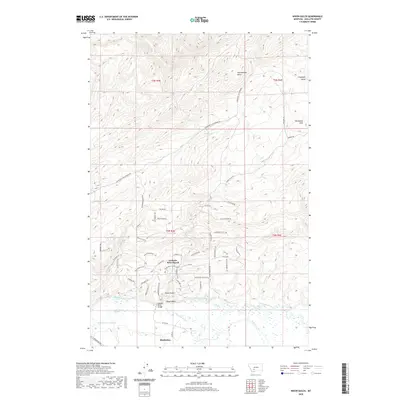
2020 Map of Nixon Gulch
USGS Topo · Published 2020About this map
The Gallatin River and East Gallatin River converge in this northern Gallatin County landscape, marking a vital hydrological junction near the town of Manhattan. To the north, the terrain rises into the Horseshoe Hills, a complex network of ridges and drainage basins including Nixon Gulch, Cottonwood Gulch, and Chipmunk Gulch. This modern survey illustrates the contemporary subdivision of the land, notably at Gallatin River Ranch, where a dense network of residential roads like Blue Bonnet RD and High Meadow RD contrasts with the open rangeland found higher in the hills. Notable landmarks like the Gallatin River Bridge and isolated water sources such as White Spring highlight the infrastructure required to manage this high-country environment where the valley floor meets the ascending mountain slopes.
Find a feature on this map
57 named features on this map. Tap any name to fly to it.
Don’t see what you’re looking for? This feature index may not catch every label — zoom into the map to look around manually.
Map Details
Editions of this 2020 Nixon Gulch Map
This is the sole edition of this map. No revisions or reprints were ever made.
Other maps of this area

1886 · Fort Logan
USGS Topo · 1:250,000

1888 · Three Forks
USGS Topo · 1:250,000

1894 · Three Forks
USGS Topo · 1:250,000

1895 · Three Forks
USGS Topo · 1:250,000

1947 · Bozeman
USGS Topo · 1:250,000

1948 · Bozeman
USGS Topo · 1:250,000

1948 · White Sulphur Springs
USGS Topo · 1:250,000

1949 · Manhattan
USGS Topo · 1:62,500

1949 · Maudlow
USGS Topo · 1:62,500

1949 · Toston
USGS Topo · 1:62,500