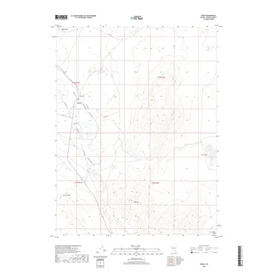
2018 Map of Nixon
USGS Topo · Published 2018About this map
The Truckee River defines the central corridor of this Nevada landscape, flowing south to north through a desert valley flanked by significant topographic elevations. The settlement of Nixon serves as the primary hub, where local infrastructure such as Church St, Eagle St, and the Po provide a framework for the community. The terrain to the west is dominated by the prominent Marble Bluff near Mud Lake Slough, while the southern reaches of the quadrangle rise into the heights of Black Mtn and the Diabase Hills. To the west, the deep indentation of Secret Canyon carries Secret Cr toward the river valley. This survey captures a specific network of local routes, including Numana Dam Rd and Little Nixon Rd, reflecting the modern transport patterns that follow the natural course of the water through this arid region.
Find a feature on this map
25 named features on this map. Tap any name to fly to it.
Don’t see what you’re looking for? This feature index may not catch every label — zoom into the map to look around manually.
Map Details
Editions of this 2018 Nixon Map
This is the sole edition of this map. No revisions or reprints were ever made.
Other maps of this area

1890 · Wadsworth
USGS Topo · 1:125,000

1892 · Wadsworth
USGS Topo · 1:125,000

1894 · Wadsworth
USGS Topo · 1:125,000

1957 · Fireball Ridge
USGS Topo · 1:62,500

1957 · Two Tips
USGS Topo · 1:62,500

1957 · Wadsworth
USGS Topo · 1:62,500

1957 · Nixon
USGS Topo · 1:62,500

1957 · Reno
USGS Topo · 1:250,000

1959 · Reno
USGS Topo · 1:250,000

1960 · Reno
USGS Topo · 1:250,000