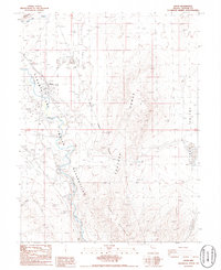
1986 Map of Nixon
USGS Topo · Published 1986About this map
The Truckee River meanders through the heart of the Pyramid Lake Indian Reservation in this mid-1980s landscape. The settlement of Nixon serves as a primary focal point, situated near a Rodeo Arena and Water Tanks. The topography is defined by the sharp rise of the Black Mountain Range to the east and the dry expanse of Alkali Flats to the northwest.
Find a feature on this map
19 named features on this map. Tap any name to fly to it.
Don’t see what you’re looking for? This feature index may not catch every label — zoom into the map to look around manually.
Map Details
Editions of this 1986 Nixon Map
This is the sole edition of this map. No revisions or reprints were ever made.
Other maps of this area

1890 · Wadsworth
USGS Topo · 1:125,000

1892 · Wadsworth
USGS Topo · 1:125,000

1894 · Wadsworth
USGS Topo · 1:125,000

1957 · Fireball Ridge
USGS Topo · 1:62,500

1957 · Two Tips
USGS Topo · 1:62,500

1957 · Wadsworth
USGS Topo · 1:62,500

1957 · Nixon
USGS Topo · 1:62,500

1957 · Reno
USGS Topo · 1:250,000

1959 · Reno
USGS Topo · 1:250,000

1960 · Reno
USGS Topo · 1:250,000