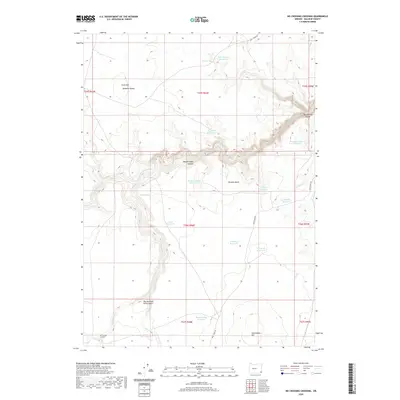
2020 Map of No Crossing Crossing
USGS Topo · Published 2020About this map
Deadman Butte and Grass Mtn anchor the northern reaches of this high desert terrain in Malheur County, where the landscape is defined by its dramatic verticality and scarce water. The rugged topography is punctuated by deep carvings like Big Antelope Canyon and the Twin Springs Gorge, while the lower flats near Sacramento Hill reveal a series of catchments with telling names.
Find a feature on this map
33 named features on this map. Tap any name to fly to it.
Don’t see what you’re looking for? This feature index may not catch every label — zoom into the map to look around manually.
Map Details
Editions of this 2020 No Crossing Crossing Map
This is the sole edition of this map. No revisions or reprints were ever made.
Other maps of this area

1955 · Jordan Valley
USGS Topo · 1:250,000

1957 · Jordan Valley
USGS Topo · 1:250,000

1958 · Jordan Valley
USGS Topo · 1:250,000

1980 · Three Forks
USGS Topo · 1:24,000
1980 · Caviatta Ridge
USGS Topo · 1:24,000
1980 · Squaw Flat
USGS Topo · 1:24,000
1982 · Rawhide Pocket
USGS Topo · 1:24,000
1982 · Starvation Spring
USGS Topo · 1:24,000
1982 · Peacock Lake
USGS Topo · 1:24,000
1982 · Rawhide Springs
USGS Topo · 1:24,000