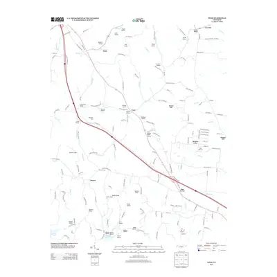
2013 Map of Noah
USGS Topo · Published 2013About this map
Noah sits at the heart of this Coffee County landscape, situated where the Noah Fork and Tallow Br meet. The area is defined by a complex network of ridges and hollows, including Cold Ridge, Walden Ridge, and the distinct high point of Farrar Hill. To the south, the waters of Normandy Lake reach into the quadrangle near Hoover Hollow, while the northern boundary is marked by the course of the Duck River passing Gnat Hill.
Find a feature on this map
167 named features on this map. Tap any name to fly to it.
Don’t see what you’re looking for? This feature index may not catch every label — zoom into the map to look around manually.
Map Details
Editions of this 2013 Noah Map
This is the sole edition of this map. No revisions or reprints were ever made.
Other maps of this area

1913 · Hollow Springs
USGS Topo · 1:62,500

1936 · Ovoca
USGS Topo · 1:24,000

1936 · Webbs Jungle
USGS Topo · 1:24,000

1936 · Fredonia
USGS Topo · 1:24,000

1936 · Manchester
USGS Topo · 1:24,000

1936 · Beech Grove
USGS Topo · 1:24,000

1936 · Petty Gap
USGS Topo · 1:24,000

1936 · Noah
USGS Topo · 1:24,000

1936 · Wartrace
USGS Topo · 1:24,000

1936 · Normandy
USGS Topo · 1:24,000