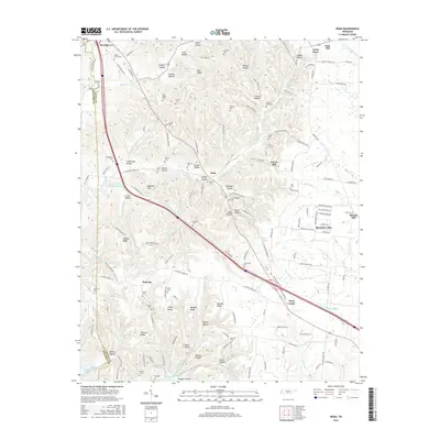
2016 Map of Noah
USGS Topo · Published 2016About this map
Beechgrove and Gnat Hill anchor this topographic view of the Tennessee landscape where Coffee and Bedford counties meet. The area is defined by a dense network of family-named hollows and ridges, such as Rayburn Hollow, Cold Ridge, and Shelton Ridge, illustrating the long-standing community ties to the local geography. Significant water features including Normandy Lake and the Duck River shape the southern and eastern edges of the quadrangle. Genealogists will find a wealth of local history in the numerous small family burial grounds like Patton Cem, Alley Cem, and Sartain Cem that dot the countryside. Along the eastern border, Strauss Mill and Boynton Valley mark the transition from the rolling hills toward the river valley, while Busy Corner serves as a notable crossroads in the central corridor.
Find a feature on this map
164 named features on this map. Tap any name to fly to it.
Don’t see what you’re looking for? This feature index may not catch every label — zoom into the map to look around manually.
Map Details
Editions of this 2016 Noah Map
This is the sole edition of this map. No revisions or reprints were ever made.
Other maps of this area

1913 · Hollow Springs
USGS Topo · 1:62,500

1936 · Ovoca
USGS Topo · 1:24,000

1936 · Webbs Jungle
USGS Topo · 1:24,000

1936 · Fredonia
USGS Topo · 1:24,000

1936 · Manchester
USGS Topo · 1:24,000

1936 · Beech Grove
USGS Topo · 1:24,000

1936 · Petty Gap
USGS Topo · 1:24,000

1936 · Noah
USGS Topo · 1:24,000

1936 · Wartrace
USGS Topo · 1:24,000

1936 · Normandy
USGS Topo · 1:24,000