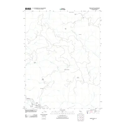
2012 Map of Noble Butte
USGS Topo · Published 2012About this map
Riverdale sits along the southern edge of this Mendocino County landscape, where the S Fork Eel River winds through a series of clearings and meadows. The map documents a rugged interior defined by family-named landmarks and rural outposts such as Pratt Place, Milsted Ranch, and Buckhorn Ranch. Significant forest features like the Captain Miles Standish Tree and the many open clearings known as "openings"—including Peterson Opening and Hiltabidels Opening—reveal a history of timber management and grazing. Outdoor recreation is centered around the Hickey Campground and Rock Creek Campground, situated near lush riparian zones like Talsma Meadow and Cabin Meadow. The complex drainage system of the E Branch S Fork Eel River and its numerous tributaries, such as Red Mountain Cr and McCoy Cr, provides a clear view of the area's hydrology before more recent developments changed the regional character.
Find a feature on this map
38 named features on this map. Tap any name to fly to it.
Don’t see what you’re looking for? This feature index may not catch every label — zoom into the map to look around manually.
Map Details
Editions of this 2012 Noble Butte Map
This is the sole edition of this map. No revisions or reprints were ever made.
Other maps of this area

1920 · Cummings
USGS Topo · 1:62,500

1920 · Harris
USGS Topo · 1:62,500

1921 · Briceland
USGS Topo · 1:62,500

1949 · Alderpoint
USGS Topo · 1:62,500

1949 · Garberville
USGS Topo · 1:62,500

1950 · Piercy
USGS Topo · 1:62,500

1951 · Alderpoint
USGS Topo · 1:62,500

1951 · Garberville
USGS Topo · 1:62,500

1952 · Leggett
USGS Topo · 1:62,500

1957 · Ukiah
USGS Topo · 1:250,000