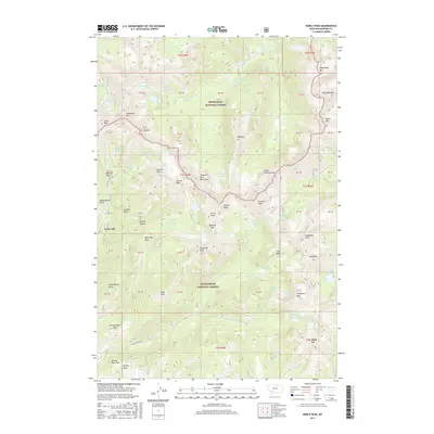
2017 Map of Noble Peak
USGS Topo · Published 2017About this map
Leiterville and the high alpine basins of the Tobacco Root Mountains dominate this survey of Madison County. The landscape is defined by the high-elevation divide between the Deerlodge National Forest and Beaverhead National Forest, where numerous glacial lakes like Louise Lake, Rossiter Lake, and the Twin Lakes are tucked beneath peaks exceeding 10,000 feet. Evidence of the region's mining history is preserved in the naming of Montana Gulch and Independence Gulch, located near the headwaters of Wisconsin Creek. Water management for the surrounding valleys is visible through high-country engineering at Bismarck Reservoir and Ziegler Reservoir. This 2017 update provides a precise look at the modern trail and road network, including Wisconsin Creek Road and Indian Creek Road, which provide access to these remote reaches.
Find a feature on this map
100 named features on this map. Tap any name to fly to it.
Don’t see what you’re looking for? This feature index may not catch every label — zoom into the map to look around manually.
Map Details
Editions of this 2017 Noble Peak Map
This is the sole edition of this map. No revisions or reprints were ever made.
Other maps of this area

1888 · Three Forks
USGS Topo · 1:250,000

1893 · Dillon
USGS Topo · 1:250,000

1894 · Three Forks
USGS Topo · 1:250,000

1895 · Three Forks
USGS Topo · 1:250,000

1947 · Bozeman
USGS Topo · 1:250,000

1948 · Bozeman
USGS Topo · 1:250,000

1950 · Harrison
USGS Topo · 1:62,500

1950 · Virginia City
USGS Topo · 1:62,500

1955 · Bozeman
USGS Topo · 1:250,000

1955 · Dillon
USGS Topo · 1:250,000