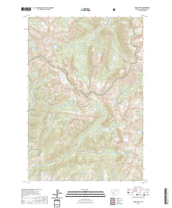
2024 Map of Noble Peak
USGS Topo · Published 2024About this map
Leiterville sits at the edge of the high country in this detailed study of the Tobacco Root Mountains. The landscape is dominated by alpine summits and glacial basins, spanning the boundary between Deerlodge National Forest and Beaverhead National Forest. Higher elevations are defined by a network of jagged peaks including Mt Jefferson, Hollowtop Mtn, and Noble Peak. Drainage patterns show the headwaters of the South Boulder River and South Willow Creek feeding out of the range, while smaller features like Bismark Reservoir and Thompson Reservoir collect runoff in the valleys. The survey captures the complex topography of the range, from the high Mustard Pass and Tom Graham Pass to the steep Spuhler Gulch. Local routes such as Mammoth South Boulder Rd provide limited access to this high-altitude environment, which remains largely shaped by its protected status and natural hydrology.
Find a feature on this map
97 named features on this map. Tap any name to fly to it.
Don’t see what you’re looking for? This feature index may not catch every label — zoom into the map to look around manually.
Map Details
Editions of this 2024 Noble Peak Map
This is the sole edition of this map. No revisions or reprints were ever made.
Other maps of this area

1888 · Three Forks
USGS Topo · 1:250,000

1893 · Dillon
USGS Topo · 1:250,000

1894 · Three Forks
USGS Topo · 1:250,000

1895 · Three Forks
USGS Topo · 1:250,000

1947 · Bozeman
USGS Topo · 1:250,000

1948 · Bozeman
USGS Topo · 1:250,000

1950 · Harrison
USGS Topo · 1:62,500

1950 · Virginia City
USGS Topo · 1:62,500

1955 · Bozeman
USGS Topo · 1:250,000

1955 · Dillon
USGS Topo · 1:250,000