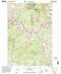
1997 Map of Noble Peak
USGS Topo · Published 2002About this map
The Tobacco Root Mountains dominate this high-altitude landscape in the late 1990s, where the extraction history of Madison County is etched into the terrain. Mining operations and prospects are scattered throughout the peaks, from the Bismarck Mine near the Bismarck Reservoir to the Lakeshore Mine tucked below Lakeshore Mountain. The small settlement of Leiterville sits on the western edge, serving as a rare point of human habitation among the numerous glacial lakes like Noble Lake and Sunrise Lake.
Find a feature on this map
77 named features on this map. Tap any name to fly to it.
Don’t see what you’re looking for? This feature index may not catch every label — zoom into the map to look around manually.
Map Details
Editions of this 1997 Noble Peak Map
This is the sole edition of this map. No revisions or reprints were ever made.
Other maps of this area

1888 · Three Forks
USGS Topo · 1:250,000

1893 · Dillon
USGS Topo · 1:250,000

1894 · Three Forks
USGS Topo · 1:250,000

1895 · Three Forks
USGS Topo · 1:250,000

1947 · Bozeman
USGS Topo · 1:250,000

1948 · Bozeman
USGS Topo · 1:250,000

1950 · Harrison
USGS Topo · 1:62,500

1950 · Virginia City
USGS Topo · 1:62,500

1955 · Bozeman
USGS Topo · 1:250,000

1955 · Dillon
USGS Topo · 1:250,000