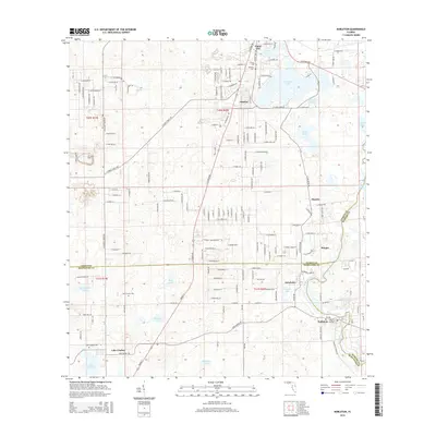
2015 Map of Nobleton
USGS Topo · Published 2015About this map
The Withlacoochee River carves through this landscape at the intersection of Citrus, Hernando, and Sumter counties, defining the eastern border of Istachatta and Nobleton. The terrain is characterized by a high density of sinkhole lakes and ponds, including Moon Lake, Bradley Lake, and the expansive Lake Lindsey to the southwest. This area preserves a quiet, rural character marked by small settlements like Floral City in the north and the cluster at Pineola.
Find a feature on this map
177 named features on this map. Tap any name to fly to it.
Don’t see what you’re looking for? This feature index may not catch every label — zoom into the map to look around manually.
Map Details
Editions of this 2015 Nobleton Map
This is the sole edition of this map. No revisions or reprints were ever made.
Other maps of this area

1893 · Panasoffkee
USGS Topo · 1:62,500

1895 · Tsala Apopka
USGS Topo · 1:62,500

1895 · Panasoffkee
USGS Topo · 1:62,500

1954 · Lecanto
USGS Topo · 1:24,000

1954 · Brooksville NW
USGS Topo · 1:24,000

1954 · Nobleton
USGS Topo · 1:24,000

1954 · Brooksville
USGS Topo · 1:24,000

1954 · Inverness
USGS Topo · 1:24,000

1954 · Brooksville SE
USGS Topo · 1:24,000

1954 · Inverness
USGS Topo · 1:62,500