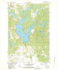
1982 Map of Nobleton
USGS Topo · Published 1982About this map
Long Lake dominates this portion of Northwest Wisconsin, its irregular shoreline punctuated by distinctive landforms like Kunz Island, Rice Island, and Christiana Point. In the early 1980s, this landscape is a patchwork of recreational and rural interests, featuring the Tomahawk Scout Reservation on the lake's eastern shore and a Golf Course to the north near Madge. The settlement of Nobleton sits at a narrow pinch point of the lake, while the surrounding woods are dotted with smaller water bodies like Big Devil Lake, Berry Lake, and Elizabeth Lake. The southern portion of the map transitions into the agricultural sections of Oak Grove, where the Brill River flows toward Cedar Lake. Local history is preserved at the Long Lake Cem and the Townhall, marking the community centers of this lake-driven geography.
Find a feature on this map
58 named features on this map. Tap any name to fly to it.
Don’t see what you’re looking for? This feature index may not catch every label — zoom into the map to look around manually.
Map Details
Editions of this 1982 Nobleton Map
This is the sole edition of this map. No revisions or reprints were ever made.
Other maps of this area

1948 · Spooner
USGS Topo · 1:48,000

1948 · Stone Lake
USGS Topo · 1:48,000

1949 · Spooner
USGS Topo · 1:48,000

1949 · Rice Lake
USGS Topo · 1:48,000

1950 · Stone Lake
USGS Topo · 1:48,000

1951 · Shell Lake
USGS Topo · 1:48,000

1951 · Rice Lake
USGS Topo · 1:48,000

1953 · Rice Lake
USGS Topo · 1:250,000

1959 · Rice Lake
USGS Topo · 1:250,000

1965 · Rice Lake
USGS Topo · 1:62,500