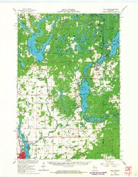
1965 Map of Rice Lake
USGS Topo · Published 1967About this map
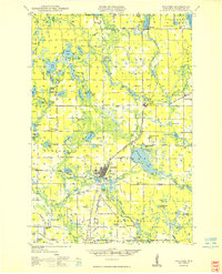
Long Lake and the interconnected waters of Cedar Lake define this northern Wisconsin landscape as it appeared in the mid-1960s. The region is characterized by a high density of glacial lakes, from the large expanse of Rice Lake in the south to the complex shoreline of Birch Lake near Birchwood. This era shows a well-established network of rural institutions, including the Oak Grove Center Sch, Lincoln Sch, and several community landmarks like Our Saviors Ch and Evergreen Ch.
Find a feature on this map
125 named features on this map. Tap any name to fly to it.
Don’t see what you’re looking for? This feature index may not catch every label — zoom into the map to look around manually.
Map Details
Editions of this 1965 Rice Lake Map
This is the sole edition of this map. No revisions or reprints were ever made.
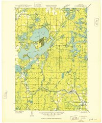
Other maps of this area

1944 · Couderay
USGS Topo · 1:48,000

1945 · Meteor
USGS Topo · 1:48,000
1948 · Couderay
USGS Topo · 1:48,000
1948 · Spooner
USGS Topo · 1:48,000
1948 · Stone Lake
USGS Topo · 1:48,000

1948 · Weyerhauser
USGS Topo · 1:48,000

1949 · Meteor
USGS Topo · 1:48,000
1949 · Spooner
USGS Topo · 1:48,000

1949 · Rice Lake
USGS Topo · 1:48,000

1950 · Weyerhauser
USGS Topo · 1:48,000