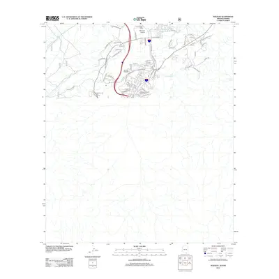
2012 Map of Nogales
USGS Topo · Published 2012About this map
Crawford Hill rises above the urban landscape of this border city in the early 2010s, overlooking a dense network of residential streets and arterial roads. The geography is defined by the Nogales Wash and the surrounding high ground of Mariposa Canyon and Ephriah Canyon. As a critical international transit point, the area features significant infrastructure like the Mariposa Land Port of Entry, which dominates the western approaches.
Find a feature on this map
61 named features on this map. Tap any name to fly to it.
Don’t see what you’re looking for? This feature index may not catch every label — zoom into the map to look around manually.
Map Details
Editions of this 2012 Nogales Map
This is the sole edition of this map. No revisions or reprints were ever made.
Other maps of this area

1905 · Nogales
USGS Topo · 1:125,000

1921 · Old Glory
USGS Topo · 1:125,000

1933 · Calabasas
USGS Topo · 1:62,500

1942 · Ruby
USGS Topo · 1:62,500

1943 · Old Glory
USGS Topo · 1:125,000

1956 · Nogales
USGS Topo · 1:250,000
1957 · Ruby
USGS Topo · 1:62,500

1958 · Nogales
USGS Topo · 1:250,000
1958 · Nogales
USGS Topo · 1:62,500

1959 · Nogales
USGS Topo · 1:250,000