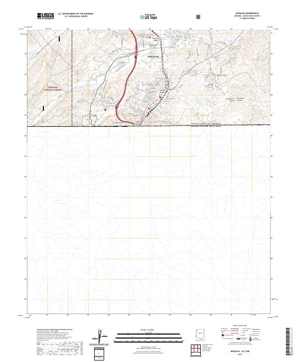
2021 Map of Nogales
USGS Topo · Published 2021About this map
Nogales sits directly against the international boundary on this contemporary survey, where the United States of America Estados Unidos Mexicanos border line is clearly delineated. The urban grid is dense with street names like N Arroyo Blvd and N Morley Ave, while prominent civic structures including the Santa Cruz County Superior Courthouse and Cochise College Nogales Santa Cruz Center anchor the northern edge of the city.
Find a feature on this map
72 named features on this map. Tap any name to fly to it.
Don’t see what you’re looking for? This feature index may not catch every label — zoom into the map to look around manually.
Map Details
Editions of this 2021 Nogales Map
This is the sole edition of this map. No revisions or reprints were ever made.
Other maps of this area

1905 · Nogales
USGS Topo · 1:125,000

1921 · Old Glory
USGS Topo · 1:125,000

1933 · Calabasas
USGS Topo · 1:62,500

1942 · Ruby
USGS Topo · 1:62,500

1943 · Old Glory
USGS Topo · 1:125,000

1956 · Nogales
USGS Topo · 1:250,000
1957 · Ruby
USGS Topo · 1:62,500

1958 · Nogales
USGS Topo · 1:250,000
1958 · Nogales
USGS Topo · 1:62,500

1959 · Nogales
USGS Topo · 1:250,000