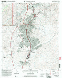
2004 Map of Nogales
USGS Topo · Published 2007About this map
The international border between Nogales, Arizona, and Heroica Nogales, Sonora, dominates this 2004 revision, illustrating the dense binational urban landscape. The terrain is marked by high-altitude features like Crawford Hill and Cerro Pelon, with the Nogales Wash flowing through the valley corridor. Significant institutional landmarks are clustered near the boundary, including the Sacred Heart Ch, Holy Cross Hospital, and the Arizona National Guard Armory.
Find a feature on this map
96 named features on this map. Tap any name to fly to it.
Don’t see what you’re looking for? This feature index may not catch every label — zoom into the map to look around manually.
Map Details
Editions of this 2004 Nogales Map
This is the sole edition of this map. No revisions or reprints were ever made.
Other maps of this area

1905 · Nogales
USGS Topo · 1:125,000

1921 · Old Glory
USGS Topo · 1:125,000

1933 · Calabasas
USGS Topo · 1:62,500

1942 · Ruby
USGS Topo · 1:62,500

1943 · Old Glory
USGS Topo · 1:125,000

1956 · Nogales
USGS Topo · 1:250,000
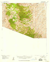
1957 · Ruby
USGS Topo · 1:62,500

1958 · Nogales
USGS Topo · 1:250,000
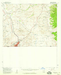
1958 · Nogales
USGS Topo · 1:62,500

1959 · Nogales
USGS Topo · 1:250,000