
1956 Map of Nohonaohae
USGS Topo · Published 1957About this map
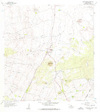
Nohonaohae rises as a prominent cinder cone in this mid-century look at the high volcanic plateaus between the Kohala and Mauna Kea regions. The landscape is defined by the critical transit point at Saddle Road Junction, where the arterial Malamahoa Highway meets Saddle Road. This intersection served as a vital link for cross-island travel and ranching operations during the 1950s. Infrastructure for the region's cattle industry is highly visible, with an extensive network of Fence Lines, water pipelines, and specialized facilities like the Old Aali Pump Station and Pakila Pump Station. The northern reaches include the Kamuela Airport, while the rugged natural drainage is marked by deep incisions like Kamakoa Gulch and Auwaiakeakua Gulch, illustrating the complex water management required in this arid volcanic terrain.
Find a feature on this map
29 named features on this map. Tap any name to fly to it.
Don’t see what you’re looking for? This feature index may not catch every label — zoom into the map to look around manually.
Map Details
Editions of this 1956 Nohonaohae Map
2 editions found
Other maps of this area

1913 · Kohala
USGS Topo · 1:62,500

1916 · Kohala
USGS Topo · 1:62,500

1916 · Waipio
USGS Topo · 1:62,500

1928 · Puako
USGS Topo · 1:62,500

1954 · Hawaii North
USGS Topo · 1:250,000

1956 · Puu Hinai
USGS Topo · 1:24,000

1956 · Kamuela
USGS Topo · 1:24,000

1956 · Keamuku
USGS Topo · 1:24,000

1956 · Makahalau
USGS Topo · 1:24,000

1956 · Kawaihae
USGS Topo · 1:24,000