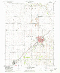
1980 Map of Nokomis
USGS Topo · Published 1980About this map
Nokomis and its neighboring coal-country settlements define this portion of the Montgomery County landscape as it appeared in the late 1970s. The town centers of Coalton, Wenonah, and the northern edge of Witt are linked by the prominent corridor of the Missouri Pacific Conrail railroad, reflecting the industrial and transit heritage of central Illinois. Extensive quarries north of Wenonah indicate active resource extraction, while the surrounding rural townships are dotted with historic institutions such as Center Grove Ch and South Fork Ch.
Find a feature on this map
39 named features on this map. Tap any name to fly to it.
Don’t see what you’re looking for? This feature index may not catch every label — zoom into the map to look around manually.
Map Details
Editions of this 1980 Nokomis Map
This is the sole edition of this map. No revisions or reprints were ever made.
Other maps of this area

1944 · Ramsey
USGS Topo · 1:62,500

1946 · Ramsey
USGS Topo · 1:62,500

1946 · Nokomis
USGS Topo · 1:62,500

1947 · Pana
USGS Topo · 1:62,500

1947 · Hillsboro
USGS Topo · 1:62,500

1949 · Hillsboro
USGS Topo · 1:62,500

1949 · Nokomis
USGS Topo · 1:62,500

1949 · Pana
USGS Topo · 1:62,500

1958 · Decatur
USGS Topo · 1:250,000

1961 · Decatur
USGS Topo · 1:250,000