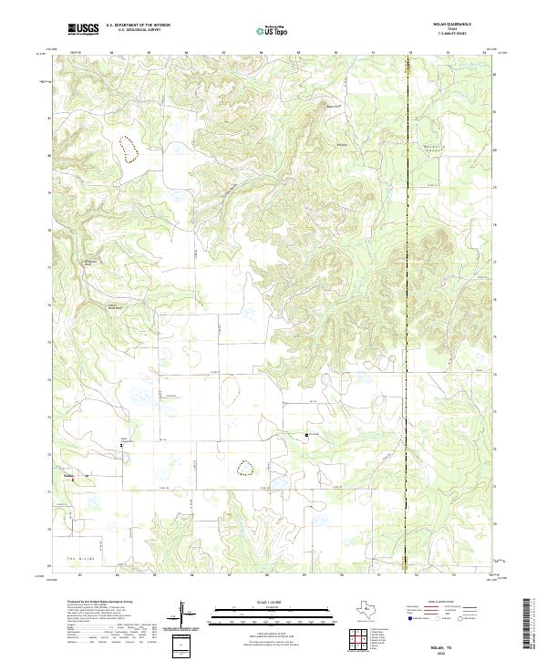
2022 Map of Nolan
USGS Topo · Published 2022About this map
The small unincorporated community of Nolan serves as the focal point for this section of the Texas Rolling Plains, where the terrain transitions toward the high-ground plateau of The Divide. The landscape is defined by its drainage systems and notable relief, featuring deep cuts like Mulberry Canyon and Coffee Hollow. Prominent elevations such as Birdsnest Bluff, Indian Hand Bluff, and Ringtop provide landmark visibility across the surrounding ranches and farmland.
Find a feature on this map
37 named features on this map. Tap any name to fly to it.
Don’t see what you’re looking for? This feature index may not catch every label — zoom into the map to look around manually.
Map Details
Editions of this 2022 Nolan Map
This is the sole edition of this map. No revisions or reprints were ever made.
Other maps of this area

1893 · Sweetwater
USGS Topo · 1:125,000

1954 · Big Spring
USGS Topo · 1:250,000

1957 · Merkel
USGS Topo · 1:62,500

1958 · Big Spring
USGS Topo · 1:250,000
1967 · Shep
USGS Topo · 1:24,000

1967 · Hylton
USGS Topo · 1:24,000

1969 · Blackwell NE
USGS Topo · 1:24,000

1969 · Holder Creek
USGS Topo · 1:24,000
1969 · Lake Sweetwater
USGS Topo · 1:24,000
1984 · Merkel West
USGS Topo · 1:24,000