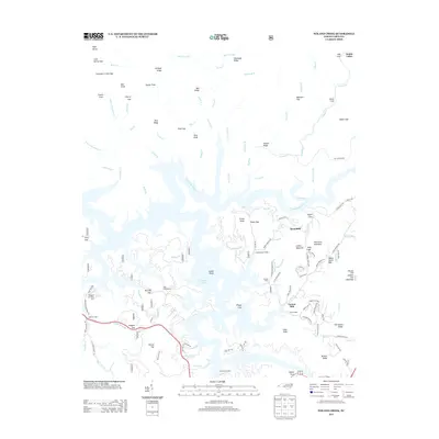
2013 Map of Noland Creek
USGS Topo · Published 2013About this map
Fontana Lake dominates this mountain landscape in Swain County, where the impounded waters of the Tuckasegee River reach deep into steep-walled coves and gaps. The map shows a transition from the managed recreational areas around Tsali Campground and various waterfront access points like Rinehart and White Dock and Almond Park Dock to the high, ridged terrain of the Great Smoky Mountains. Significant topographic landmarks include Collins Mountain, Pilot Knob, and Shear Knob, while the northern reaches are defined by a complex drainage system featuring Forney Cr and Noland Cr. Small settlements and historic local nodes such as Roundhill, Carson Mill, and Solola Valley appear alongside an intricate network of forest roads and trails, including New Fontana Rd and Round Hill Rd, illustrating the intersection of residential life and the preserved wilderness of the Blue Ridge.
Find a feature on this map
142 named features on this map. Tap any name to fly to it.
Don’t see what you’re looking for? This feature index may not catch every label — zoom into the map to look around manually.
Map Details
Editions of this 2013 Noland Creek Map
This is the sole edition of this map. No revisions or reprints were ever made.
Other maps of this area

1886 · Knoxville
USGS Topo · 1:125,000

1891 · Cowee
USGS Topo · 1:125,000

1892 · Knoxville
USGS Topo · 1:125,000

1893 · Mt Guyot
USGS Topo · 1:125,000

1894 · Knoxville
USGS Topo · 1:125,000

1895 · Knoxville
USGS Topo · 1:125,000

1897 · Cowee
USGS Topo · 1:125,000

1901 · Knoxville
USGS Topo · 1:125,000

1907 · Cowee
USGS Topo · 1:125,000

1912 · Mt Guyot
USGS Topo · 1:125,000